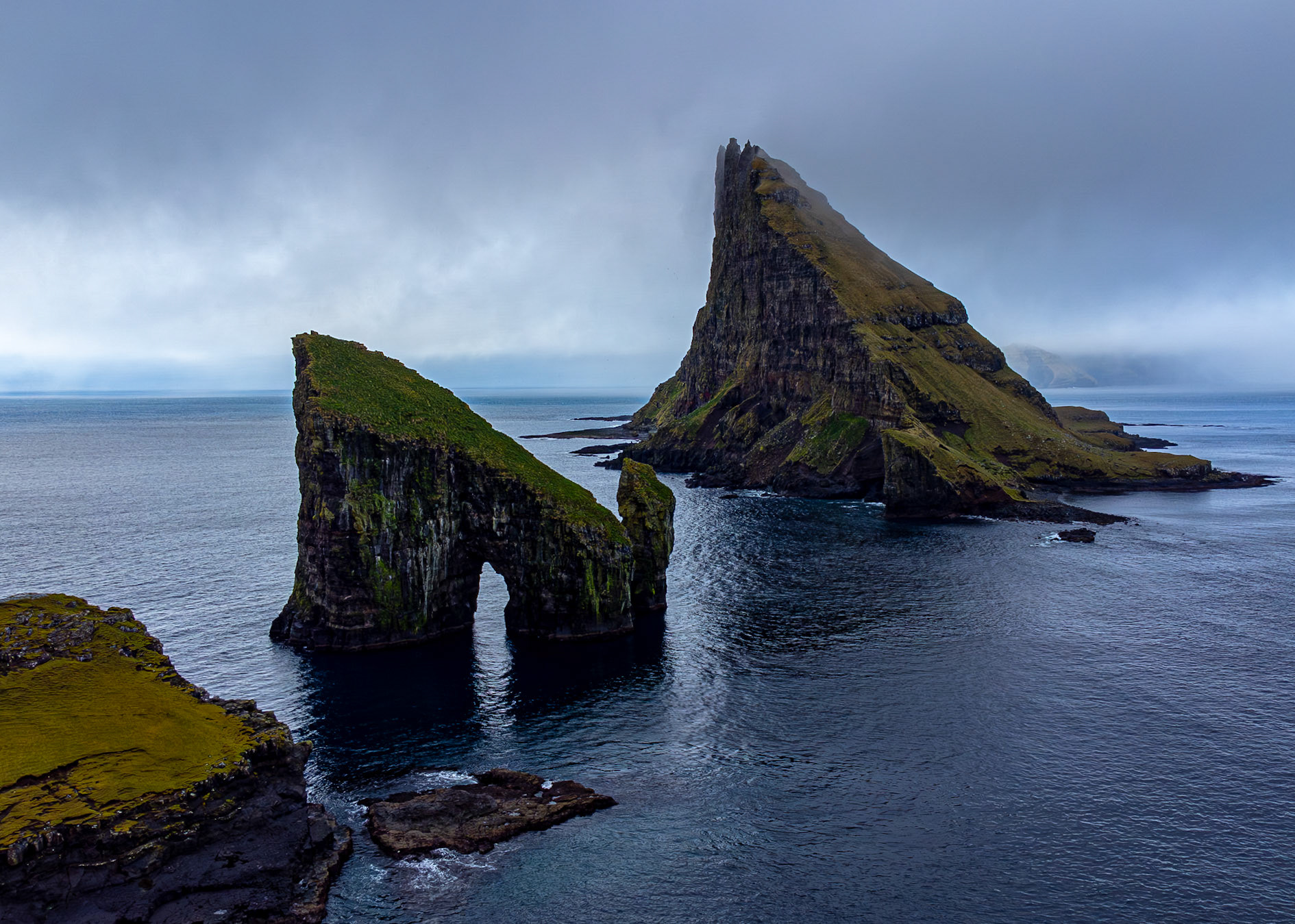
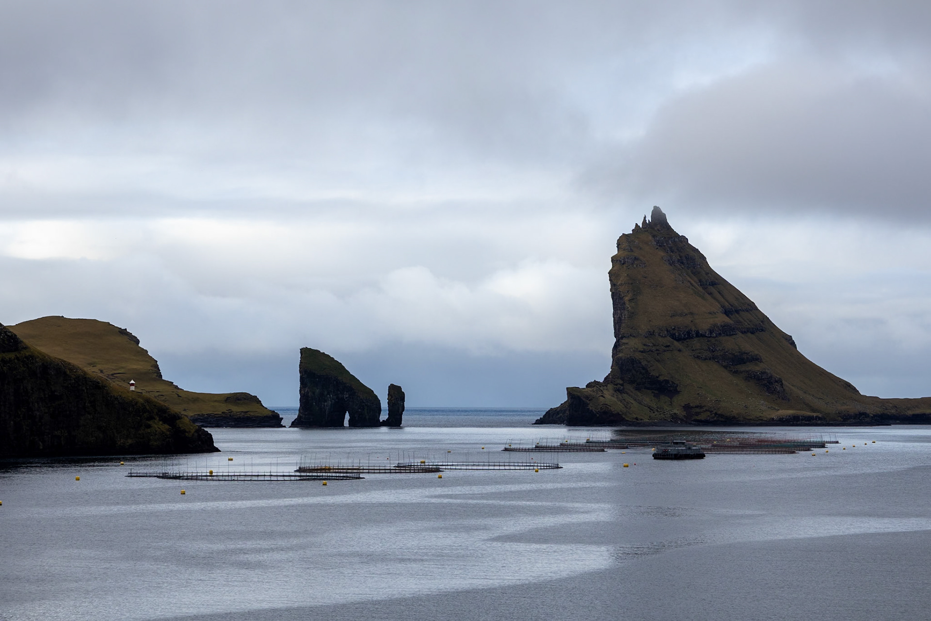
The famous sea stacks Drangarnir
The night we arrived in the Faroe Islands set the tone for the whole trip: fog, clouds, and rain.
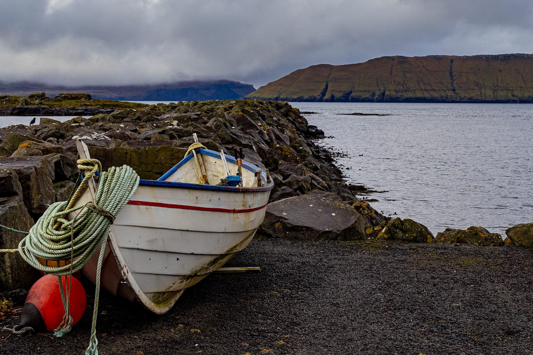
After picking up the rental car, we quickly made it to our first apartment in Sørvágur. It was a small place on the ground floor of a larger building with one main room with a kitchen, dining table, and bed, plus a short hallway and a tiny bathroom with a very low ceiling. The host lived upstairs, but we never met them.
Our first contact with the Faroe Islands was the local supermarket. It was tiny, but had everything we needed for a quick, cold dinner.
Gásadalur
The next day, we checked out of the apartment and wandered through the sleepy town. There wasn’t much to see, and with the weather hiding the sunrise, we quickly moved on to our first stop: Gásadalur. This small village sits on the western tip of the island of Vágar, right next to the island’s most famous attraction, the waterfall Múlafossur. To reach it, you follow a winding road along the coastline before entering a narrow, one-lane tunnel. The tunnel is the only road to Gásadalur (13 inhabitants in 2023) and passes through the mountain Knúkarnir, connecting the village to the rest of the islands.
The viewpoint across the waterfall offers a stunning view of Vágar’s cliffs, with Múlafossur and the village in the background. Small steps carved into the mountain allow a precarious descent down to sea level, allowing a different viewing angle on the cliffs and waterfall. We arrived very early and spent quite a bit of time taking in the scenery and trying to capture some good photos. By the time we finished, a couple of larger tourist groups had arrived, so we decided to move on to our next stop.
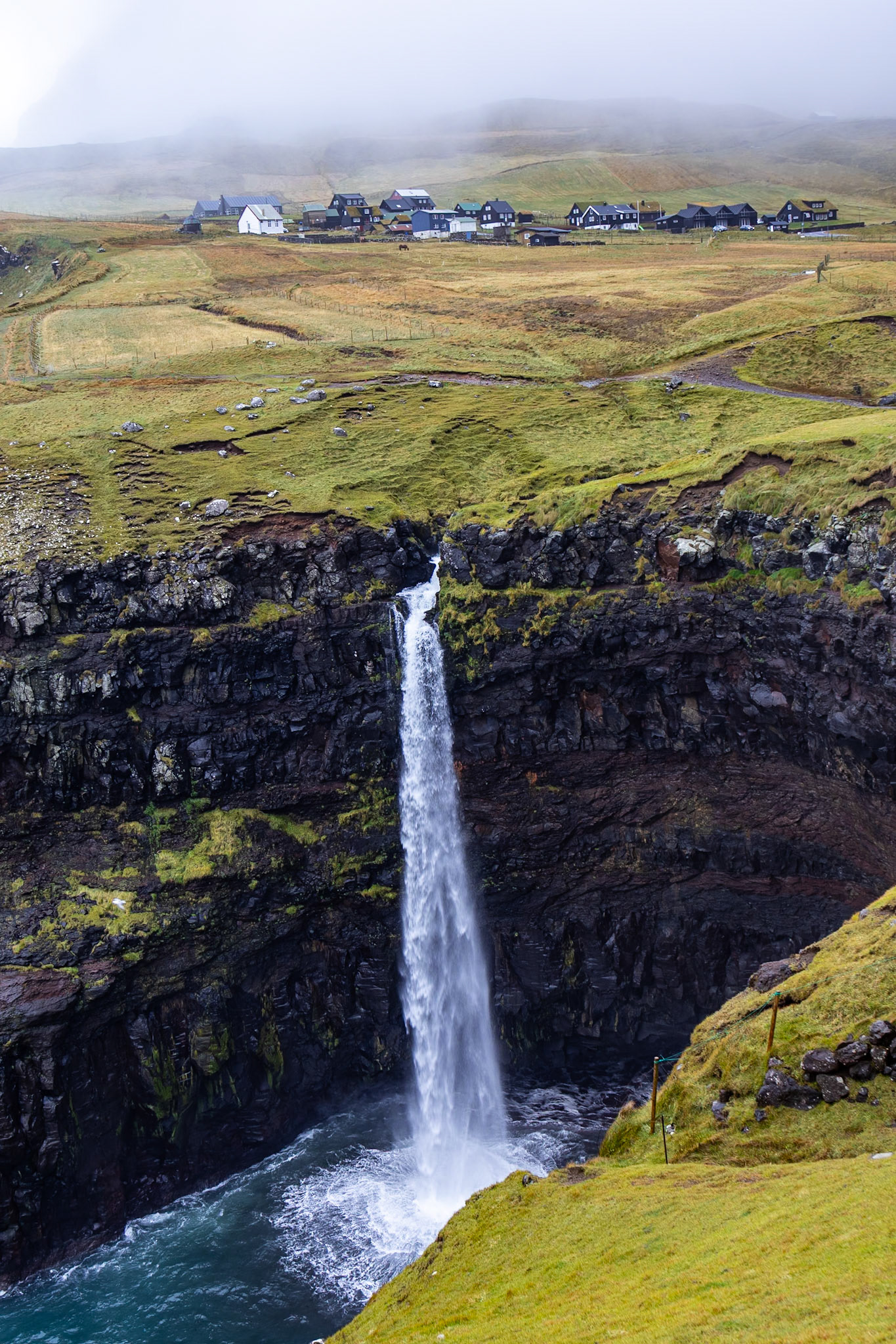
Múlafossur with Gásadalur
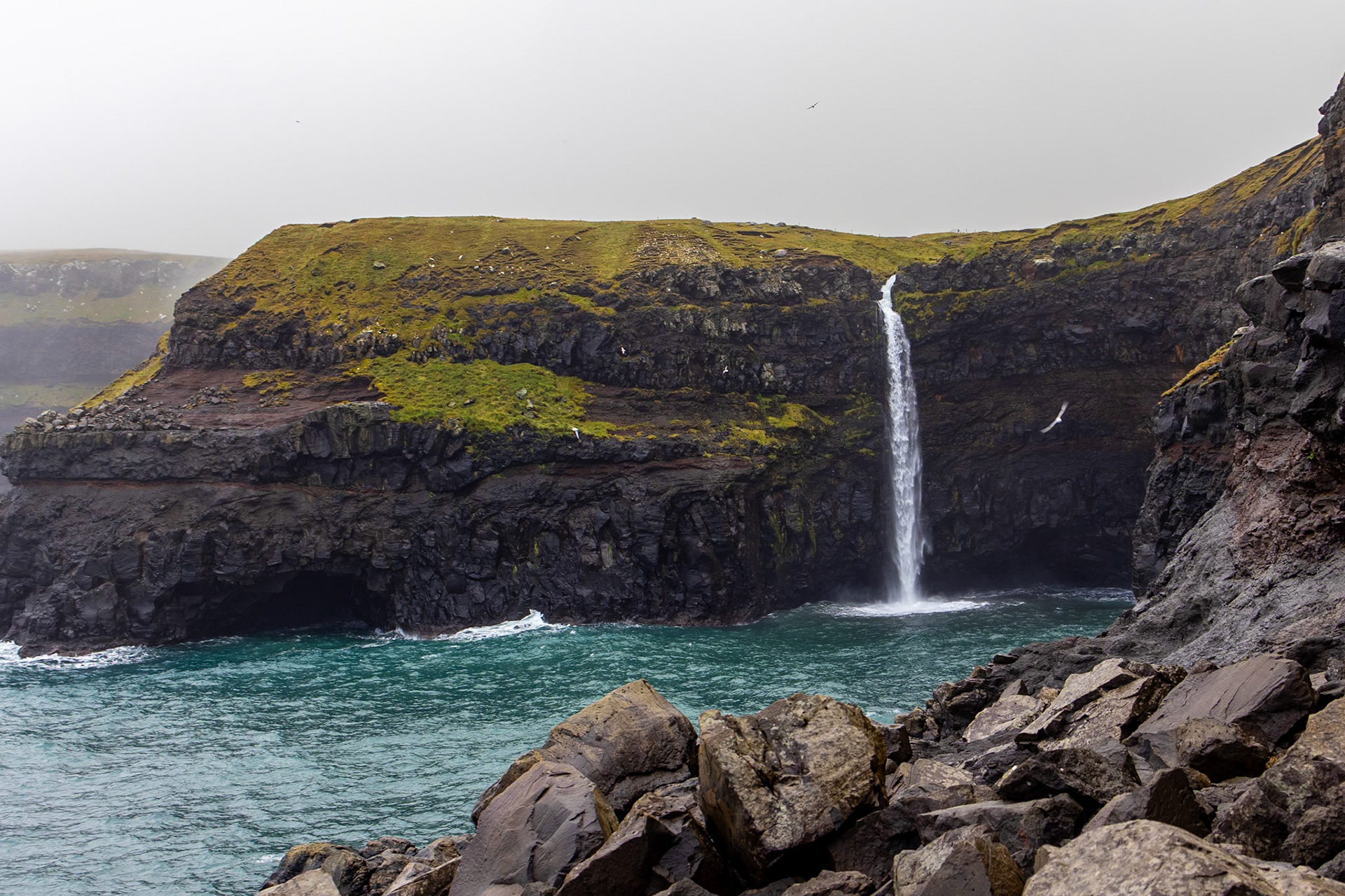
Múlafossur from sea level
Trælanípa
Restaurants in Faroe are sparse, and off season even more so. Therefore we drove all the way to the other side of Vágar to the town Sandavágur. We had a little snack and coffee to warm up before we continued our journey to the next stop.
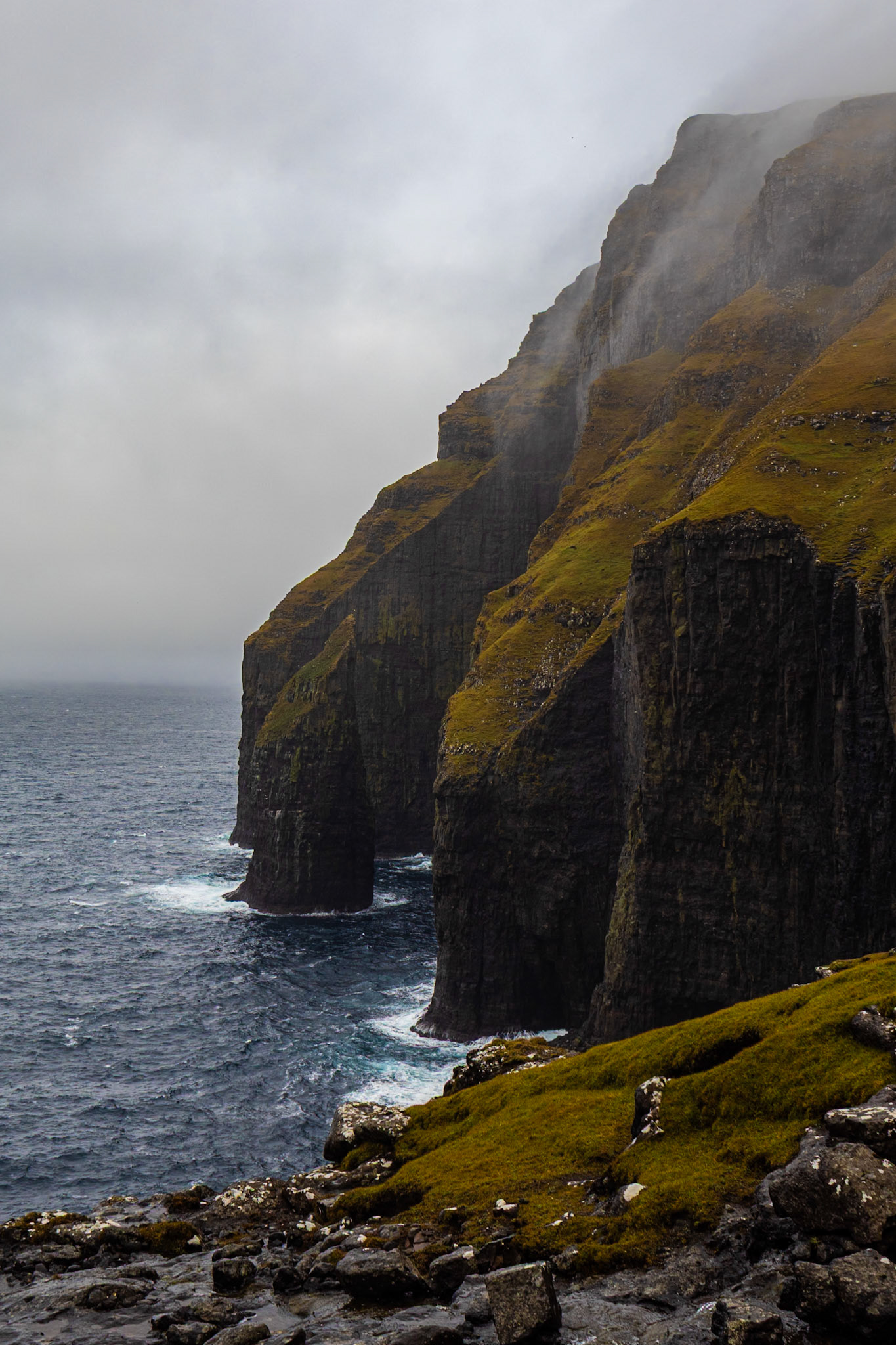
Trælanípa is a cliff rising 142 meters above the Atlantic. From the top, you’re supposed to see an optical illusion where the lake Sørvágsvatn appears high above the ocean. The cliff can be reached via a 3 km hike starting near the town of Miðvágur. It’s an easy walk through breathtaking scenery, with small waterfalls and grazing sheep along the way.
Unfortunately, by the time we arrived, it was very foggy with a constant drizzle. After climbing the muddy, wet stairs to the top, all we saw was white fog.
Fossá
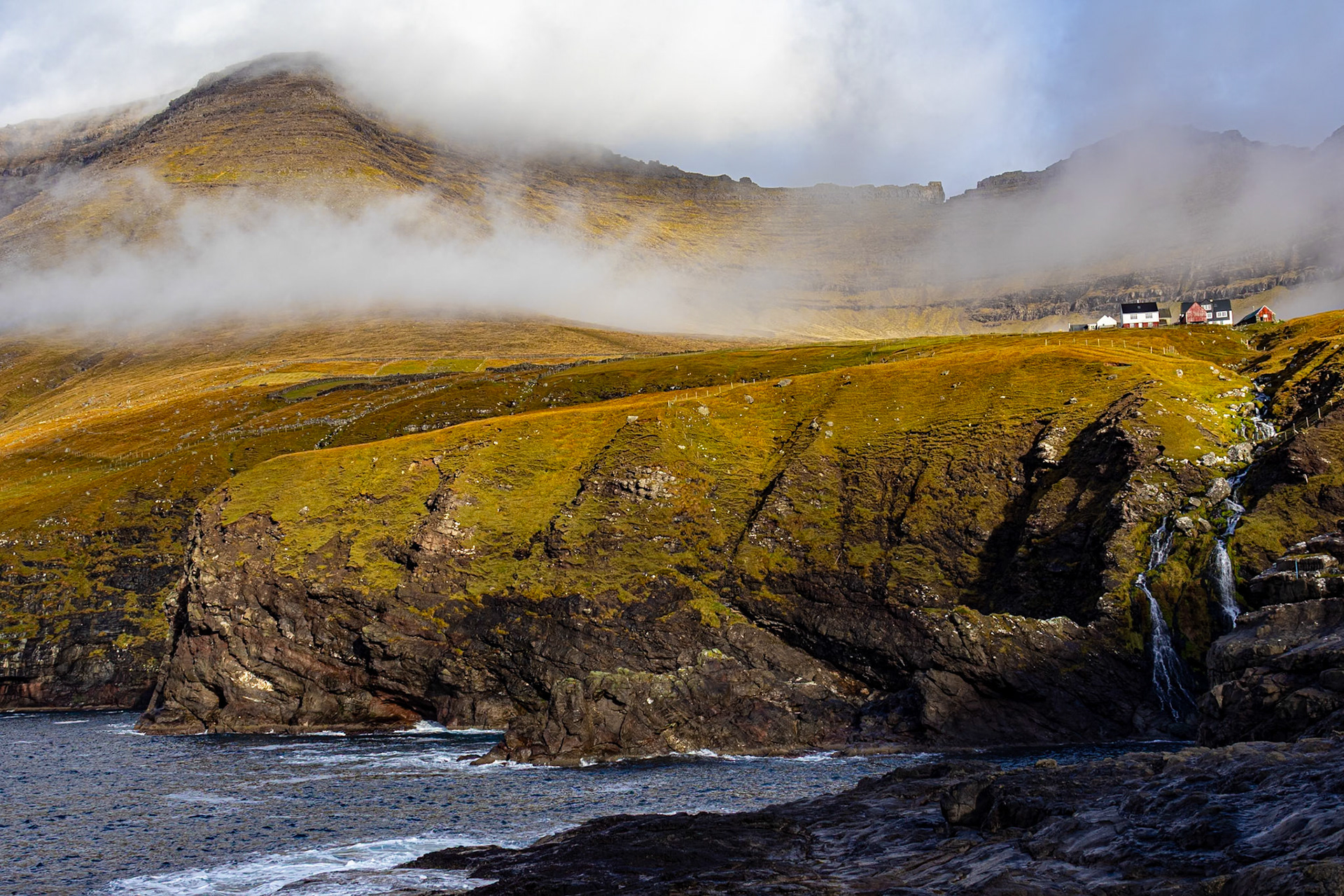
Our next stay was on the northern island of Borðoy. We decided to take the scenic northern route through the islands, passing by small villages along the way. With a small detour, we reached the waterfall Fossá.
The waterfall is 140 meters tall, divided into two levels. From the road, you can only see the bottom section. The top is visible only from the neighboring island or with a drone. We visited Fossá twice during our stay, and on the second visit I was able to make a drone video of the entire waterfall.
Population of 1
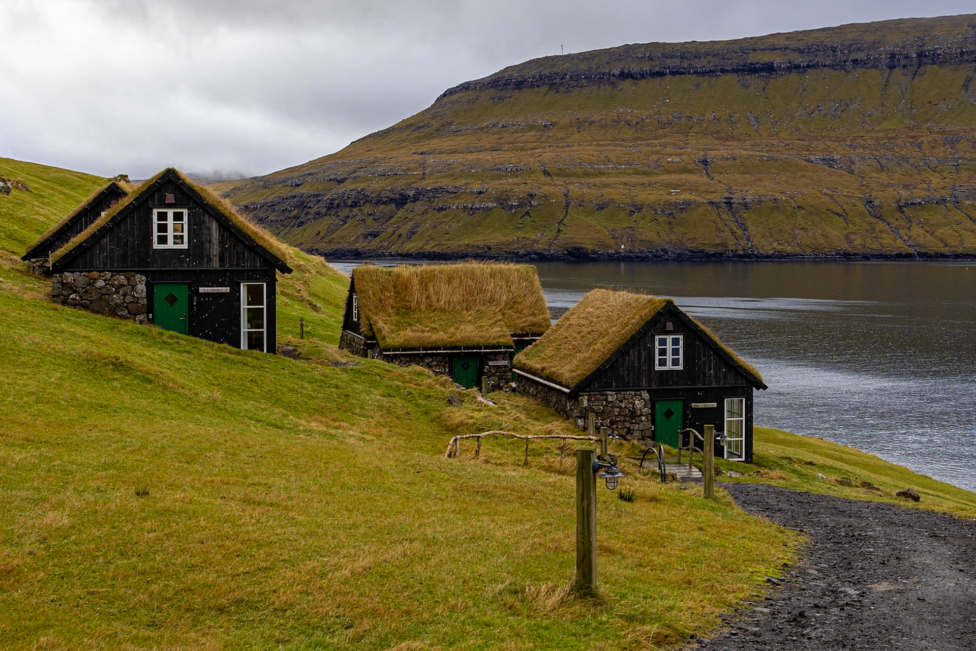
After a long drive, we arrived at the small cottage we had booked. It’s located in Depil, a tiny settlement on a bay between the islands of Borðoy and Viðoy. Only a quiet road and a small field separate it from the bay, which is surrounded by tall mountains on all sides.
Depil currently has a population of five (2025), but a few years ago, when a tourist sign was printed, the population was just one.
The North
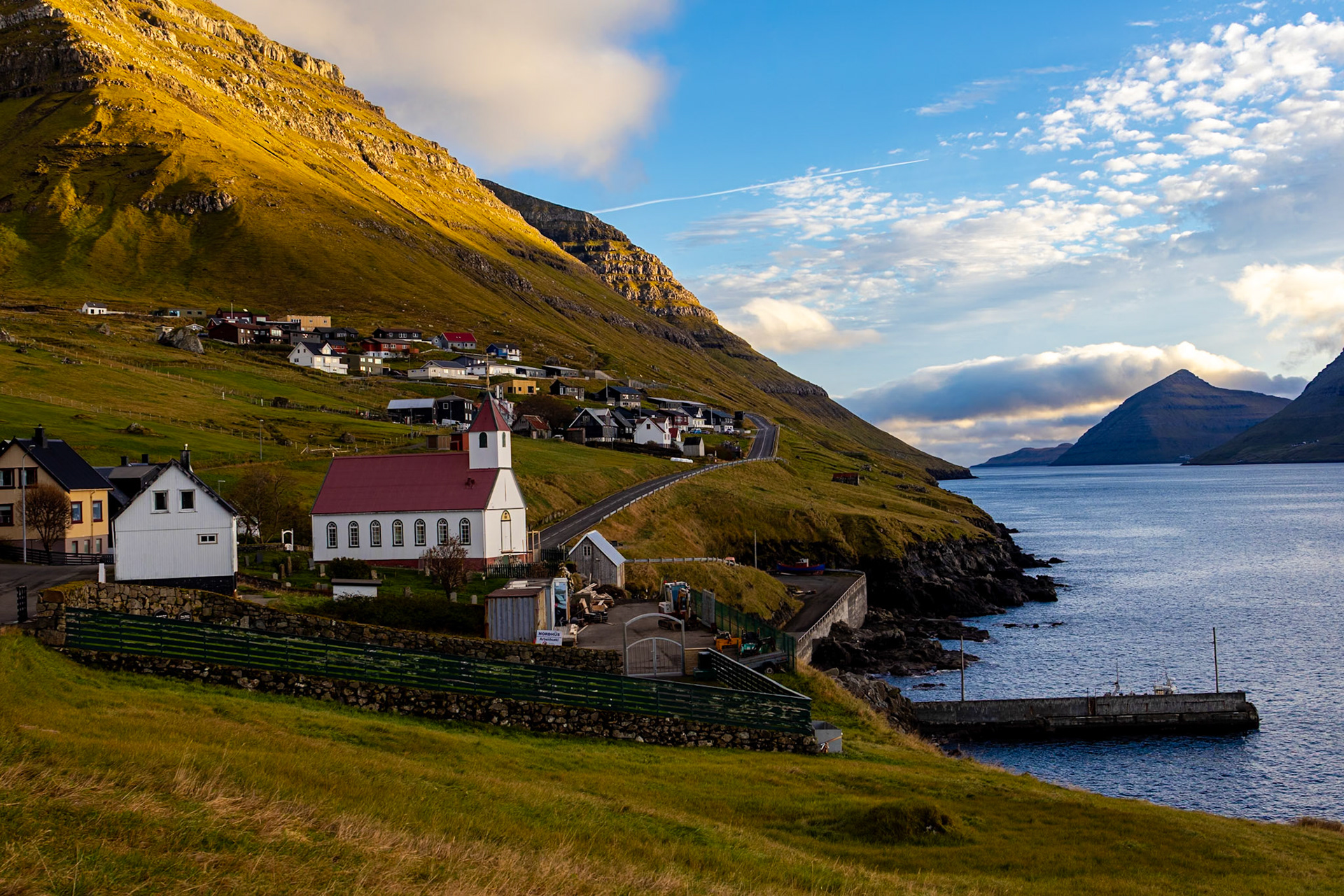
From the cottage, it was only a short drive to the neighboring villages of Norðdepil and Hvannasund, separated by a narrow strait and linked by a small bridge.
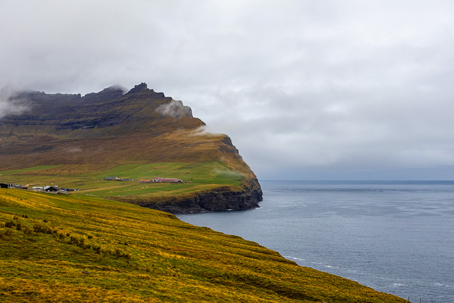
After a brief stop in Hvannasund, we continued north to Viðareiði, the northernmost village in the Faroe Islands. Nestled between two steep mountains on the island’s western coast, the village overlooks dramatic cliffs and neighboring islands. A nearby viewpoint offers sweeping views of the landscape and the sea beyond.
Klakkur mountain ridge
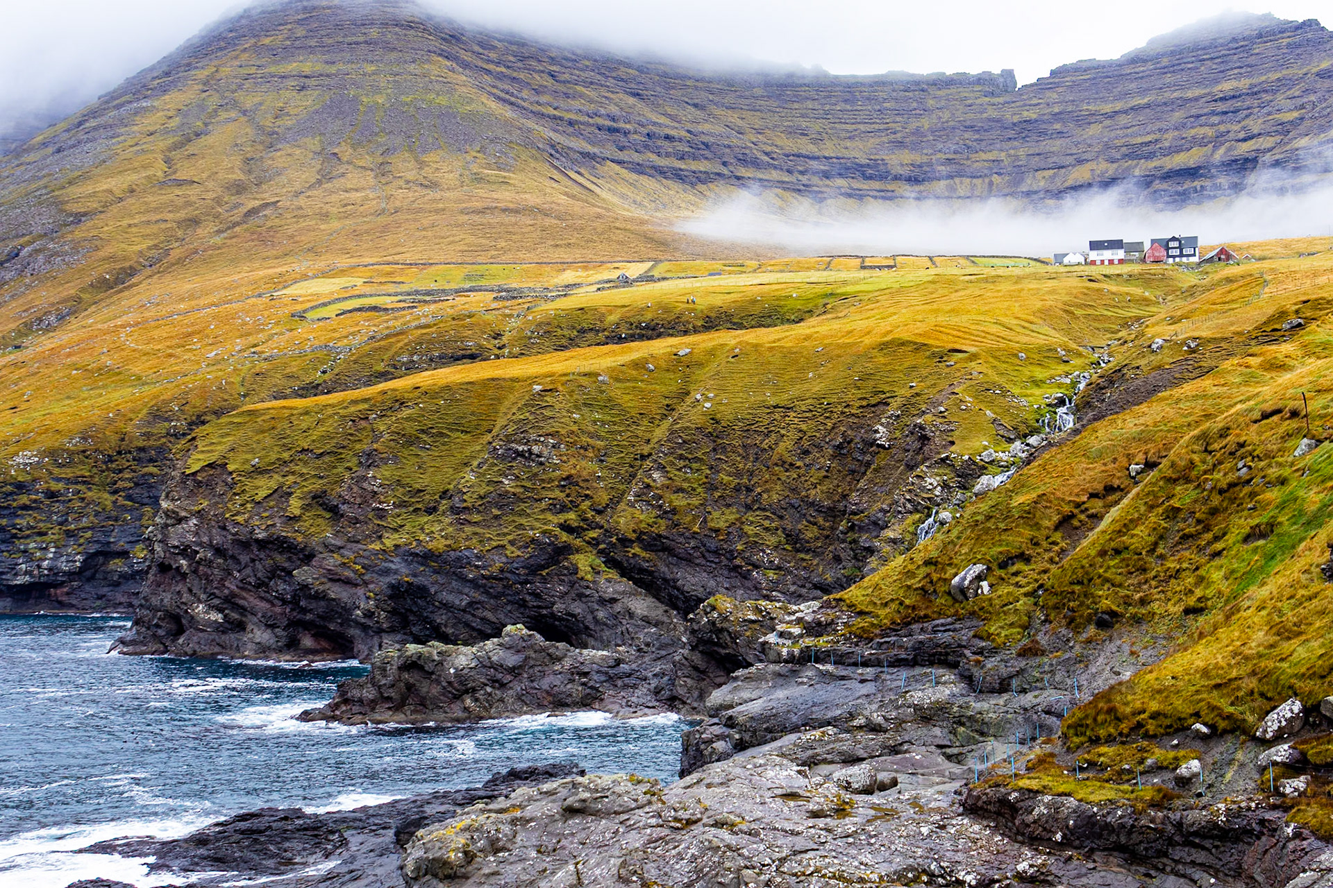
From Viðareiði, we continued to Múli, a small settlement across the fjord on the neighboring island. According to our travel guide, it was once a ghost town, but when we arrived, we found that several houses were inhabited again. Since there wasn’t much to see, we carried on and stopped at a small bakery in Klaksvík, the second largest town in the Faroe Islands.
From there, we set out to climb Klakkur, the mountain ridge overlooking the town. The trail was not particularly difficult, but the rain had turned it into a wet, muddy climb. Reaching the top revealed a breathtaking panorama, a full circle of mountains, fjords, and open sea stretching in every direction.
View from Klakkur
After a short drive to the village of Kunoy (population 64) on the island of Kunoy, we returned to the cottage for a quiet evening at home.
Kunoy
Aurora borealis
Late at night, just after midnight, we received an alert that the northern lights might be visible. We rushed outside, and within minutes a faint glow began to shimmer across the sky. Slowly, the aurora unfolded, green and purple waves dancing above the dark silhouettes of the mountains. Through the camera lens, the spectacle appeared even more vivid, a surreal finale to our day in the north. As we stood in the cold, watching the lights shift and fade, two shooting stars streaked across the sky.
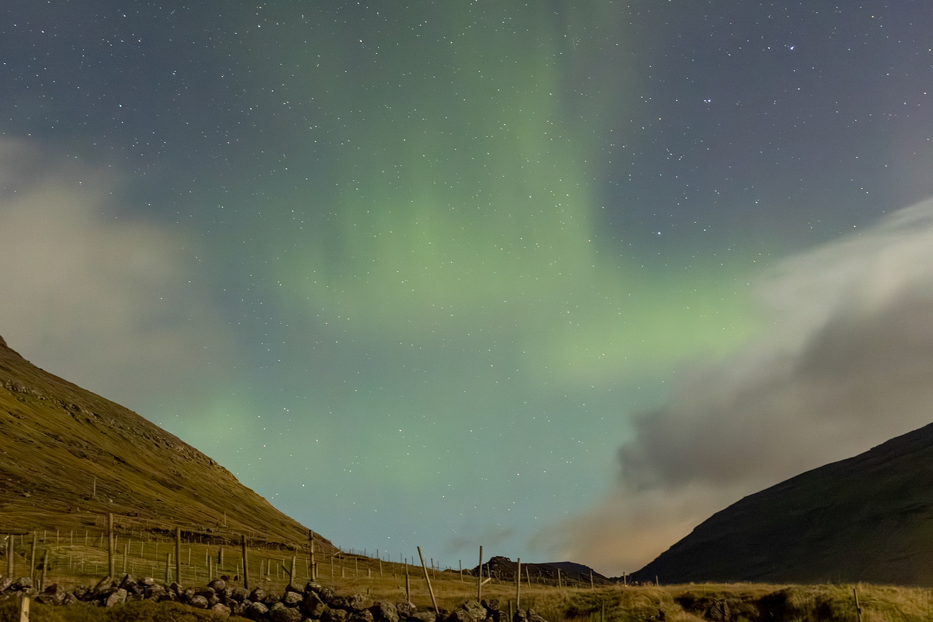
The aurora visible from our cottage

The aurora revealing different colors
Big city life
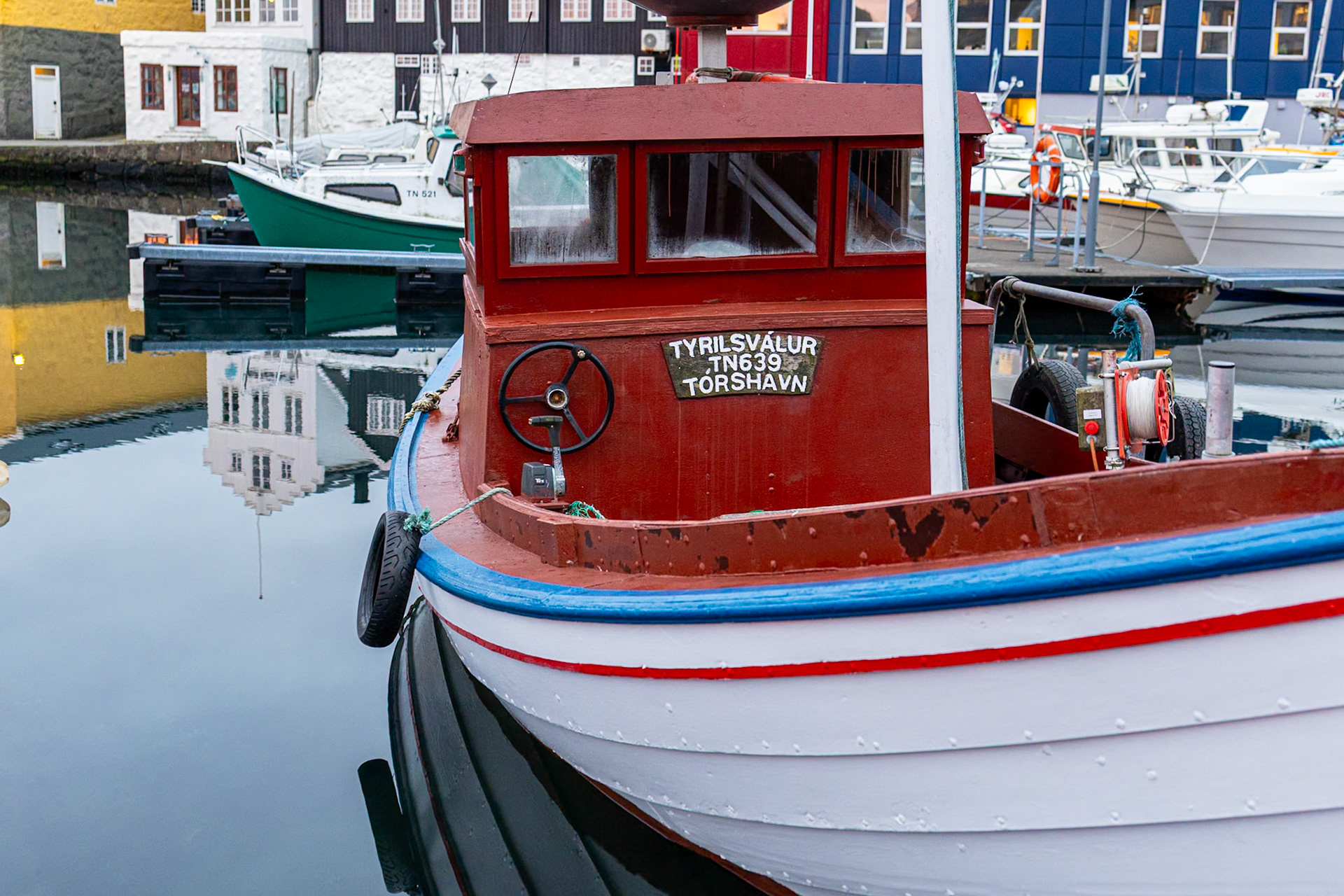
The next day, we left our quiet little cottage and headed south to the Faroese capital, Tórshavn (population over 14,000), which would serve as our home base for the rest of the trip.
After checking into our hotel, we grabbed our cameras and set out for a stroll through the harbor and nearby neighborhoods. It doesn’t take long to reach all the main sights on foot; everything in Tórshavn feels close and intimate despite its status as the country’s largest town. In the evening, we celebrated my birthday at the aptly named Angus Steakhouse.
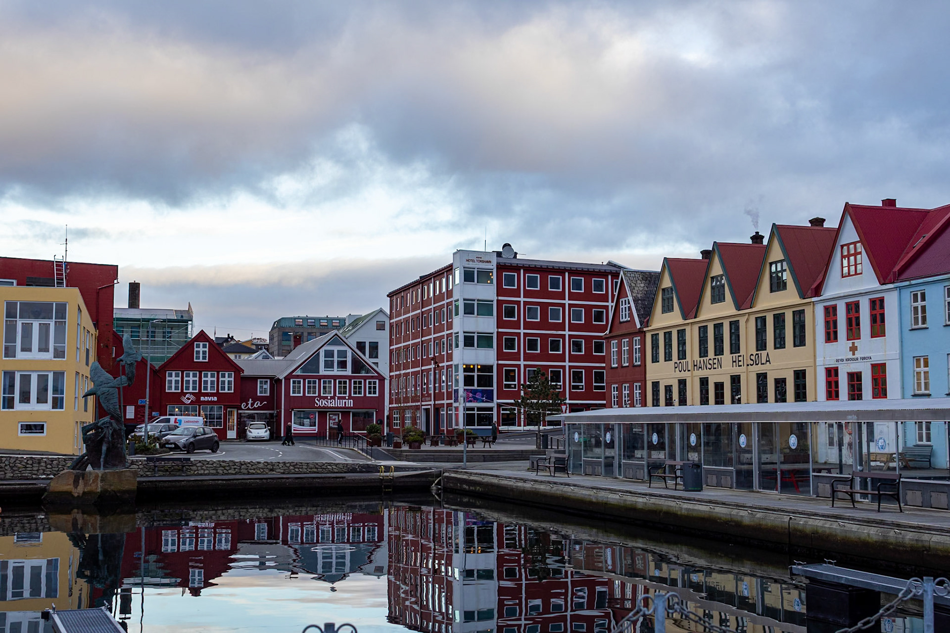
Tórshavn
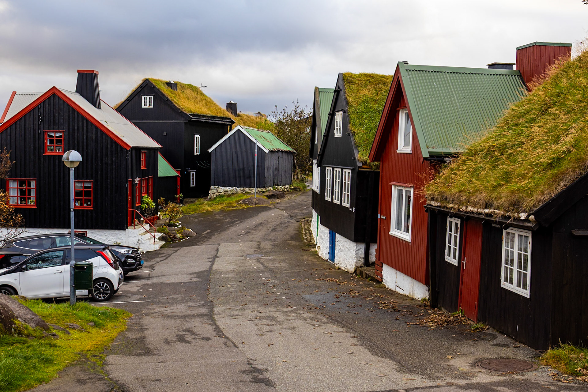
Old Town in Tórshavn
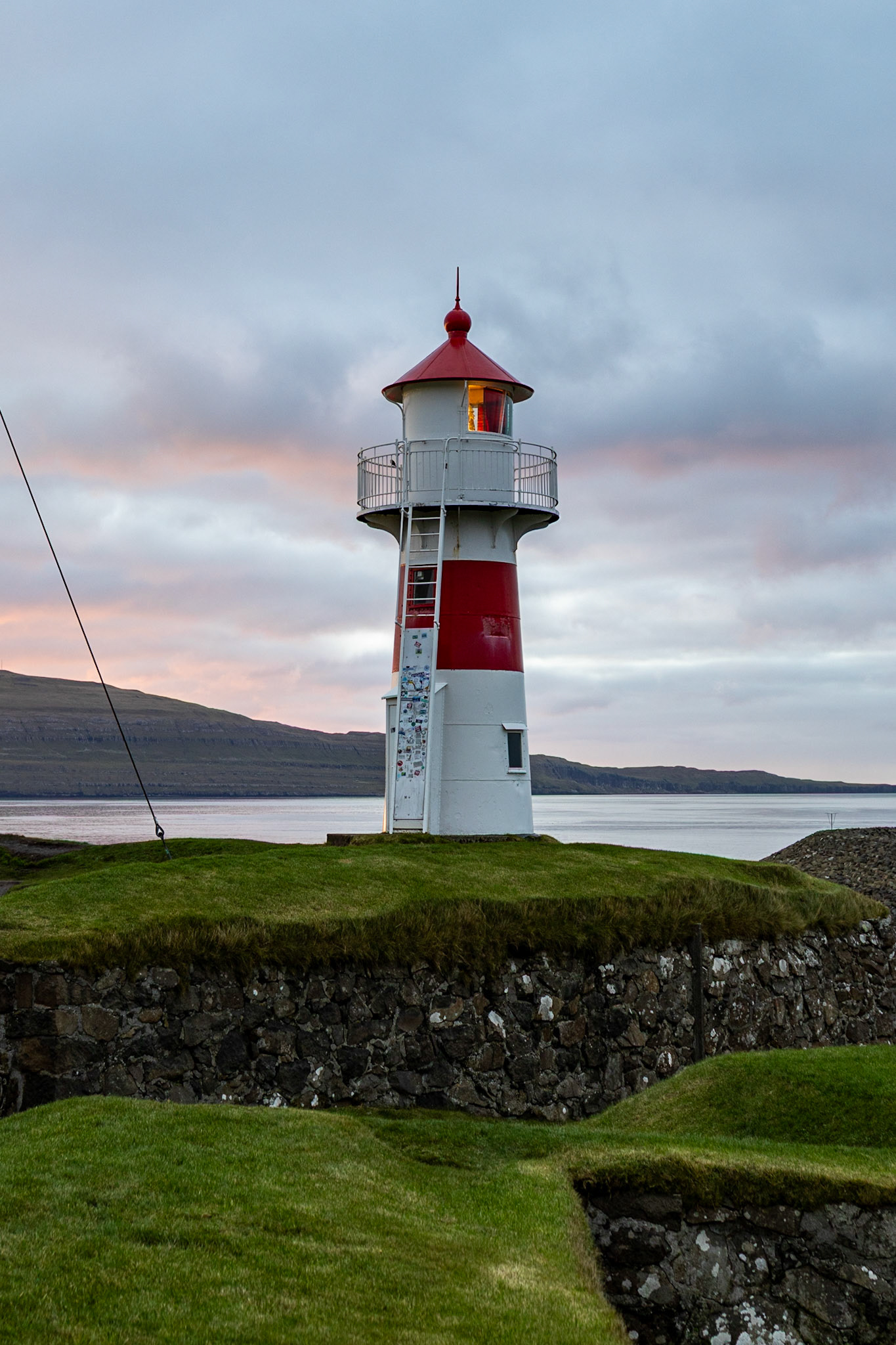
Lighthouse in Tórshavn
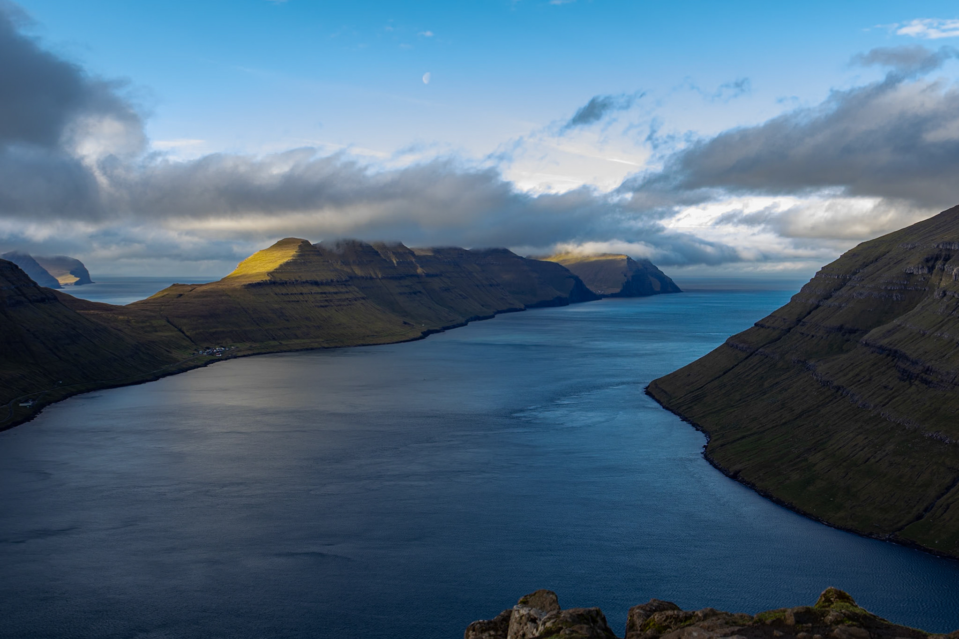
Eysturoy and Streymoy
Our first road trip from Tórshavn took us to explore the two largest islands of the Faroes. We began with Funningur, a quiet little village on the island of Eysturoy, nestled between steep mountains at the edge of the sea.
From there, a narrow, winding road climbs over the mountains to the island’s northern coast and the peaceful village of Gjógv. The town is named after its dramatic natural harbor, a deep, narrow bay (gorge) where small boats find shelter from the open sea.
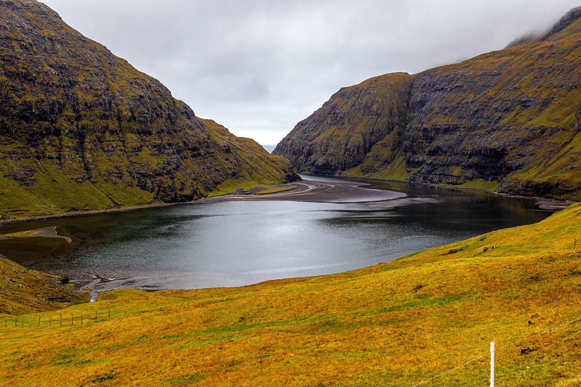
On the same day, we also stopped by the villages of Haldórsvík, Tjørnuvík, Saksun, and Vestmanna. Each of them was small, quiet, and strikingly beautiful with its clusters of colorful houses surrounded by towering mountains and open sea.
Saksun, in particular, stood out with its breathtaking view over the tidal lagoon Pollurin, where black sand meets the green slopes of the valley.
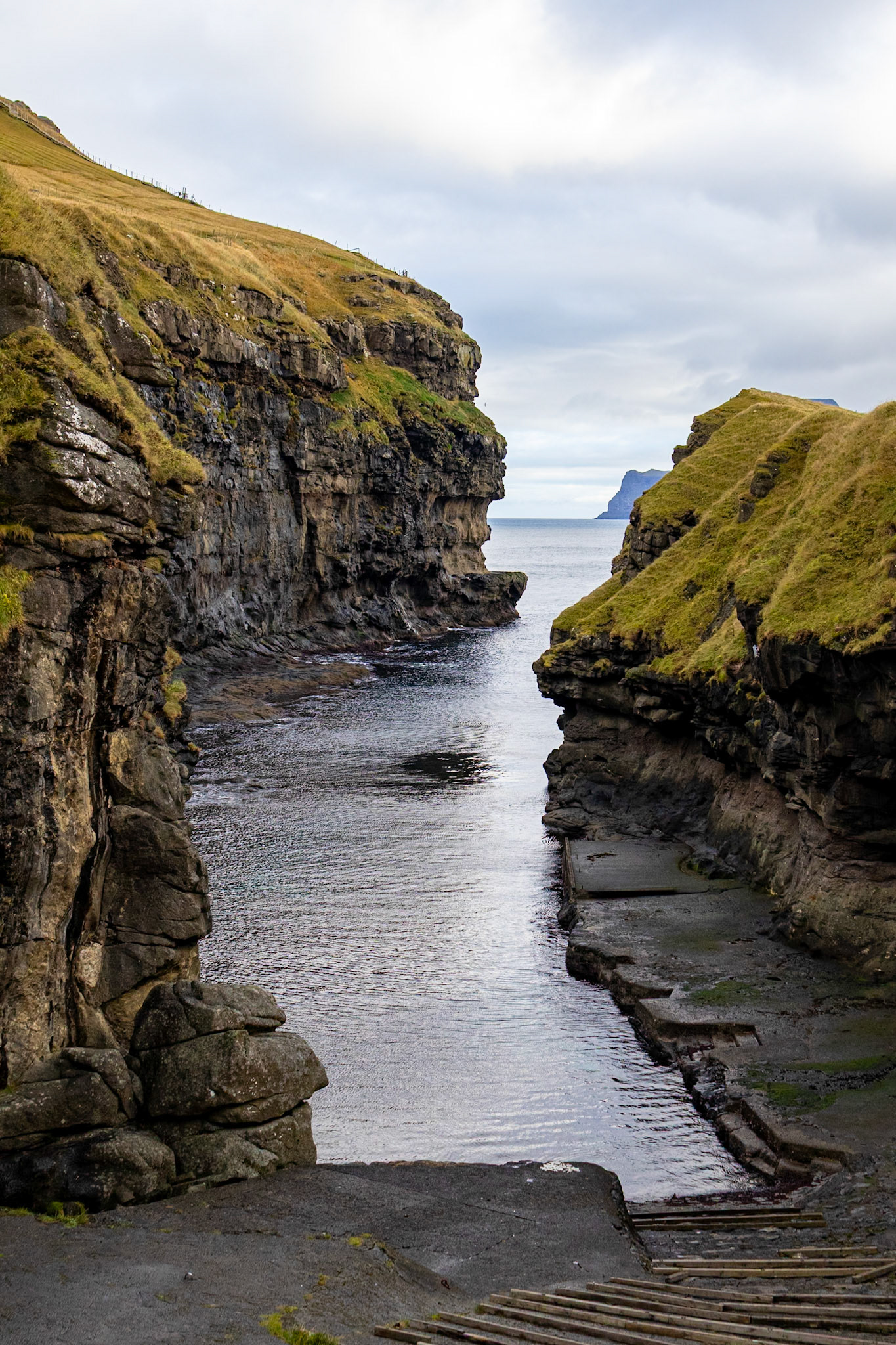
The natural harbor of Gjógv
View from Saksun to the tidal lagoon Pollurin
The south
The next day, we got up early to catch the ferry to Suðuroy, the southernmost of the Faroe Islands (its name literally means “South Island”). The MS Smyril carries around 1,000 passengers and 200 cars, taking just over two hours to connect Tórshavn with Suðuroy.
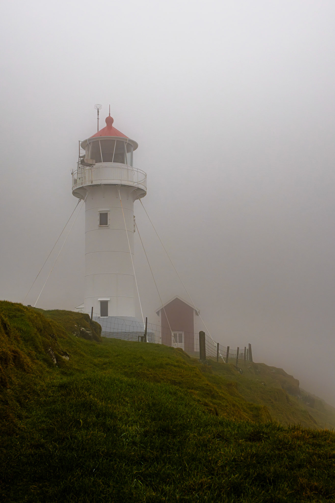
Unfortunately, the weather wasn’t on our side. The island was cloaked in thick fog for most of the day, hiding its dramatic cliffs and sweeping views. At the remote southern tip, we visited the Akraberg Lighthouse, which stood barely visible in the mist. The surrounding area drops steeply into the sea, and each step had to be chosen carefully to avoid slipping into the depths.
After visiting a few small villages along the way, we parked near Sandvík and set out on a roughly one-hour hike to the viewpoint for Ásmundarstakkur, one of the island’s most striking sea stacks. A small signpost marks the beginning of the trail, which leads off the road through open, muddy fields dotted with grazing sheep. The closer we got to the cliffs, the stronger the wind became, so strong that the nearby waterfall was blown upward. The fog revealed just enough to glimpse the spectacular, dramatic cliffside up close, jagged rock faces disappearing into the mist, waves crashing far below, and the sense of standing at the very edge of the world.
We continued the hike up the cliffs to a small, precarious wooden bridge said to offer an even better view of the coastline. But the bridge was slick with rain, and with the fog still clinging to the cliffs, there wasn’t much to see anyway. After the hike, we wrapped up our expedition to the southern island and slowly made our way back to the harbor. There, we had an early dinner before boarding the ferry back to the main island.
Akraberg Lighthouse
Ásmundarstakkur
TN24 Norðlýsið
The next day, we joined the charter boat TN24 Norðlýsið for a roughly three-hour trip around the island of Nólsoy, just off the coast from Tórshavn. The island is small, with the village of Nólsoy situated at its narrowest point, stretching from east to west.
Its steep cliffs rise dramatically from the sea, and from the boat, they felt even more imposing. On the island’s eastern side, the route passes through the open Atlantic, where large waves rocked the boat and made it tricky to move from one side to the other.
The Sun
The next day, we didn’t have many plans. Checking the live webcams, we spotted a few breaks in the clouds over the island of Vágar and decided to revisit some of the sights from our first day. Time was short, because the weather was already shifting again, but on the road back to Gásadalur, the sky was clear, revealing the famous sea stacks of Drangarnir. With the drone, I managed to fly across the bay and capture close-up photos without having to charter a boat or join one of the pricey guided hikes.
Afterward, we set out to hike to another of Vágar’s iconic landmarks: Trøllkonufingur, the “Troll Woman’s Finger.” The rock formation rises like a single stone finger from the cliffs. Unfortunately, by the time we arrived, the fog had rolled back in, thick and heavy, and we could barely make out the shape through the mist.
The end
We dedicated our last day in the Faroe Islands to history and culture. In the morning, we visited the nearby village of Kirkjubøur, where we explored the ruins of the Magnus Cathedral and the surrounding historic farmhouses. Afterward, we continued to Tjóðsavnið, the National Museum near Tórshavn, to learn more about Faroese life and traditions.
In the evening, we concluded our journey with a traditional dinner at Áarstova, a cozy restaurant by the harbor in Tórshavn, the perfect place to reflect on our week among the wind, cliffs, and clouds of the Faroe Islands.
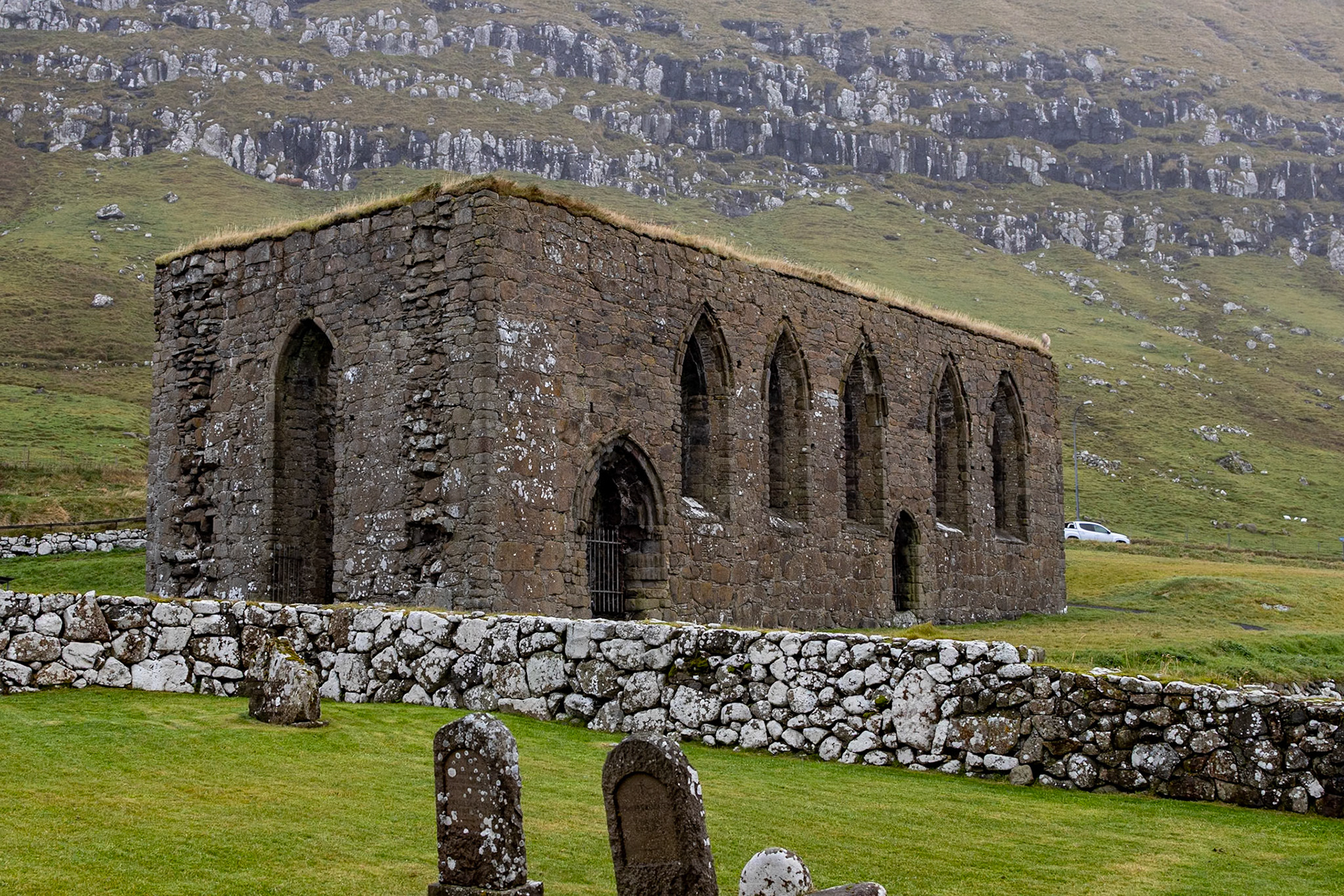
Magnus Cathedral
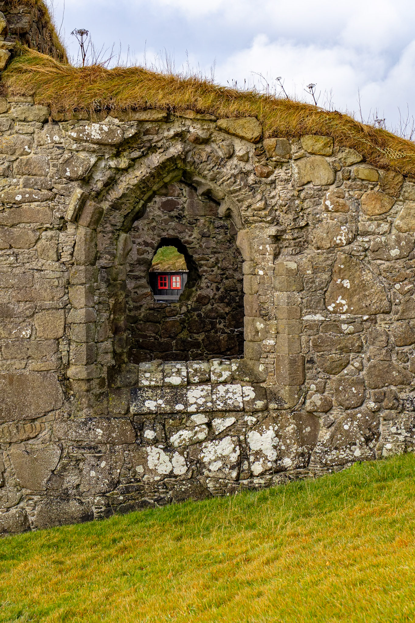
Magnus Cathedral
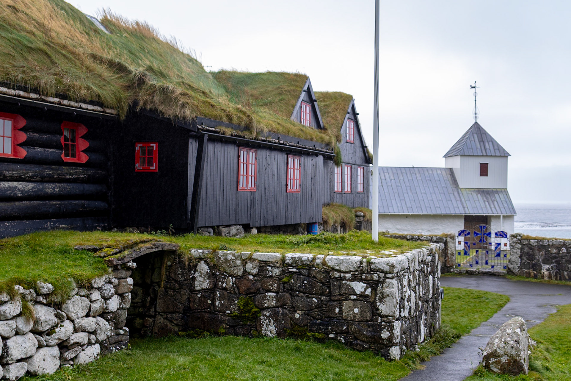
Kirkjubøur